Commission 3D city models from a known world leader and support your projects with visually and spatially accurate digital twins.
We've built 3D reality mesh models in the US, Australia, New Zealand, France, and Germany for a broad client list. 3D data is an ideal staging environment whether you're in engineering, construction, town planning, or asset management. Manage and change the world within an accurate rendition of the present and reduce your planning and consultation time.
Our award-winning 3D modeling service provides an end-to-end solution: the whole workflow from flight planning and image acquisition to 3D processing and delivery is all done in-house. Contact Us about capturing your area or Download a free sample of our data.
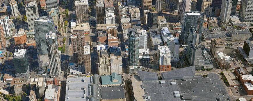
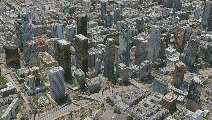
Our capture specialists are operating in the Western region of the United States from the Rocky Mountains to the Pacific supporting the data needs of those booming areas.
Models range from 1 sq km to 25 sq km with 2 & 5-cm resolutions and 5 & 10 cm absolute accuracy. All standard 3D formats are available; OBJ, FBX, Esri SLPK, and Cesium 3D Tiles.
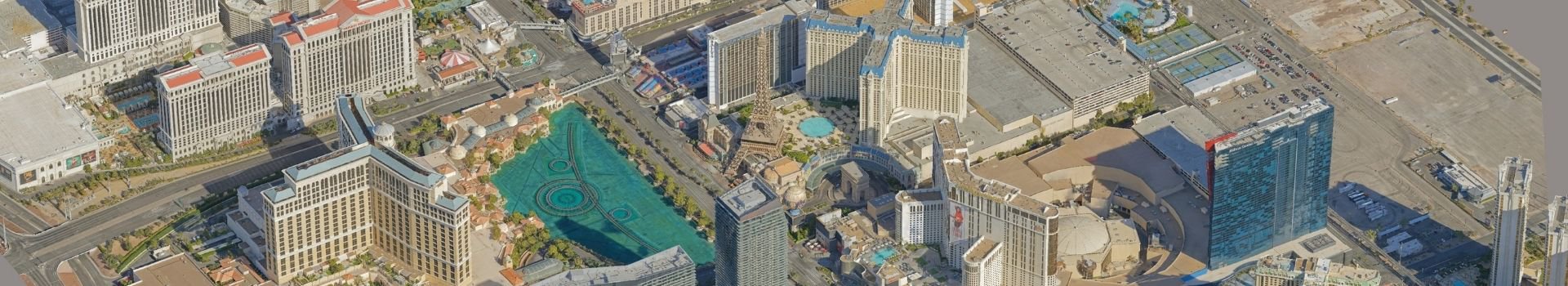
GO TO OUR MODEL LIBRARYGovernment & City planners in multiple countries trust Aerometrex 3D data to provide the imagery detail and real-world accuracy for their digital twins. See the large-scale view and the fine details in a single model augmented with your city’s municipal data.
Visualize the future of your city by tracking change and simulating scenarios in full 3D. Our flexible captures generate 3D data where you need it. Focus on new developments, renewal projects, main streets, or town squares.
Aerometrex data comes Esri-ready; whether you work in ArcGIS Pro, Urban, or City Engine. We support many other platforms too, including Bentley, Cesium, Skyline, and more.
Let us recreate the present so you can focus on building the future.
With Aerometrex 3D capture there’s no more need to manually build the environment surrounding your projects. Our high-res mesh is the infinitely flexible spatial solution for your future developments. Derive years of utility from a single, precise data source.
Place your BIM, LOD, or fully textured models anywhere within the spatially-accurate dataset. From a single building to a new freeway, there’s no better solution than 3D data.