
Jason Karian, Esri Solutions Engineer, shows how powerful Aerometrex 3D data is when added to Esri's ArcGIS Urban platform. ArcGIS Urban is a scenario-based planning platform, letting city managers and AEC professionals create, test, and share alterations to the built environment. Esri's platform consumes all of the relevant planning and regulatory data you need and Aerometrex's 3D reality mesh gives you real-world context and spatial precision to manage high complexity and large-scale projects.
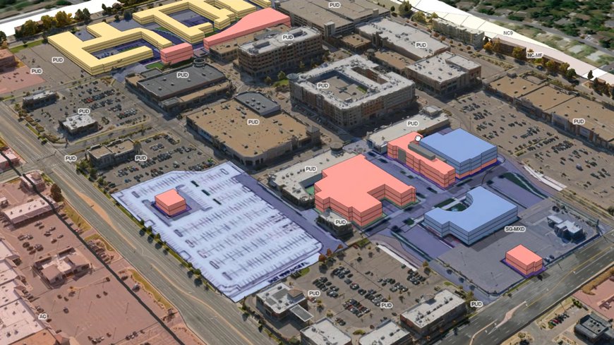
Join Jason Karian, Esri Solutions Engineer, for a guided tour of Esri's ArcGIS Urban platform using Aerometrex 3D Reality Mesh